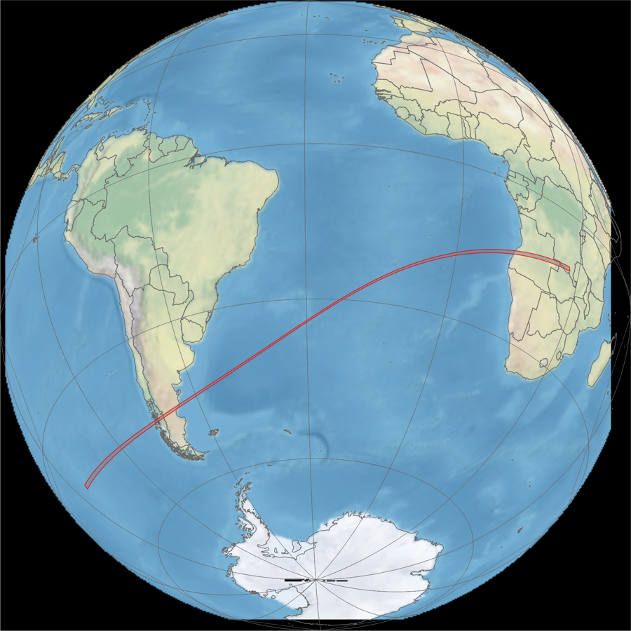
2017 February 26
Annular Solar Eclipse
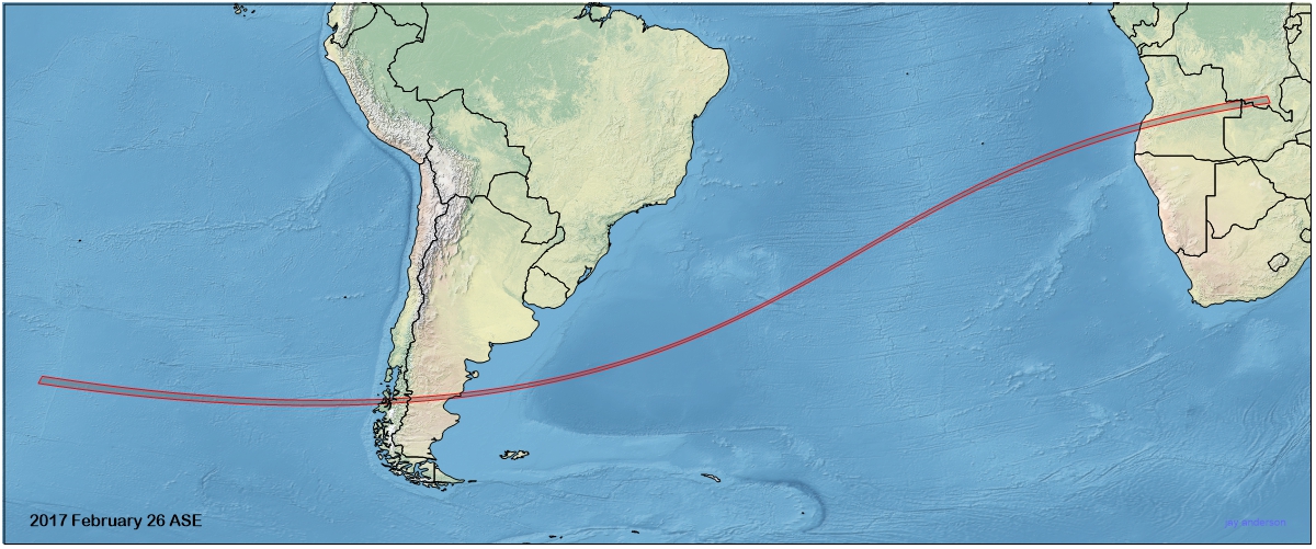
Map of the track of the 2017 annular solar eclipse. Eclipse track: Xavier Jubier.
Animation of the passage of the lunar shadow created in WinEclipse, a program developed by the late Heinz Scsibrany.

Shadow of the annular eclipse over the South Atlantic from the EPIC satellite. Image: NASA.
Animation of the eclipse shadow using the EPIC camera aboard the DSCOVR satellite. This satellite is located at one of the Earth’s Lagrangian points, a distance of 1.6 million km from the planet. The Earth turns below the camera, in contrast to geostationary satellites that remain fixed over a single point. Images: NASA.
Animation of the eclipse shadow from Meteosat 10. Images: EUMETSAT/SSEC UW-Madison.
Updated January 2021
Return to eclipsophile home page