2017 August 21
Total Solar Eclipse
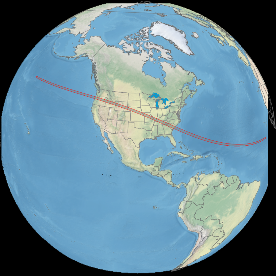
Totality for the 2017 solar eclipse was an entirely American experience for those who viewed from land.
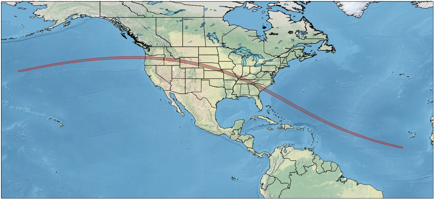
Track of the 2017total solar eclipse. Eclipse track: Xavier Jubier. Background: NASA.
Animation of the passage of the lunar shadow created in WinEclipse, a program developed by the late Heinz Scsibrany.
In 2017, the new GOES 16 satellite was available to record the passage of the lunar shadow in three colours that could be assembled into a natural-looking image.
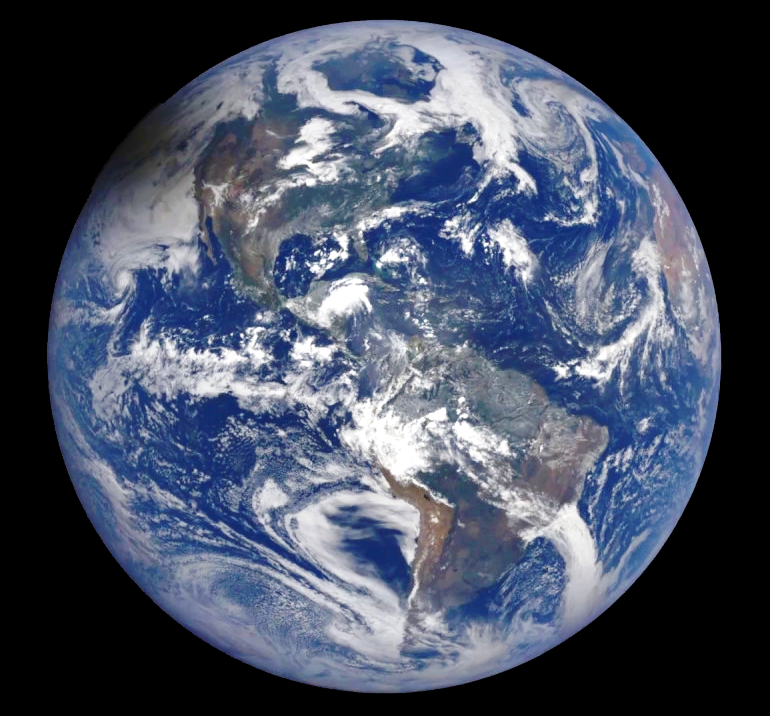
The eclipse shadow approaches over the west limb of the Earth as seen in this GOES East image. Image: NASA.
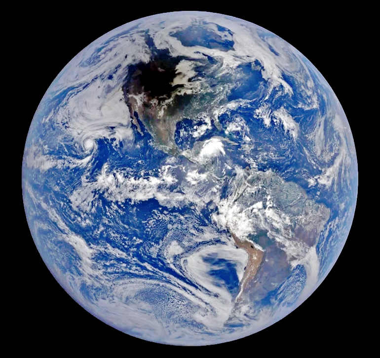
An animation from the DSCOVR satellite in orbit at one of the Earth’s Lagrangian points, 1.6 million km from the planet. The EPIC camera aboard the satellite captures an image every 2 hours and shows the Earth rotating beneath the spacecraft. Images: NASA.
A full-disk animation of the passage of the eclipse shadow from GOES East. Video: NASA.
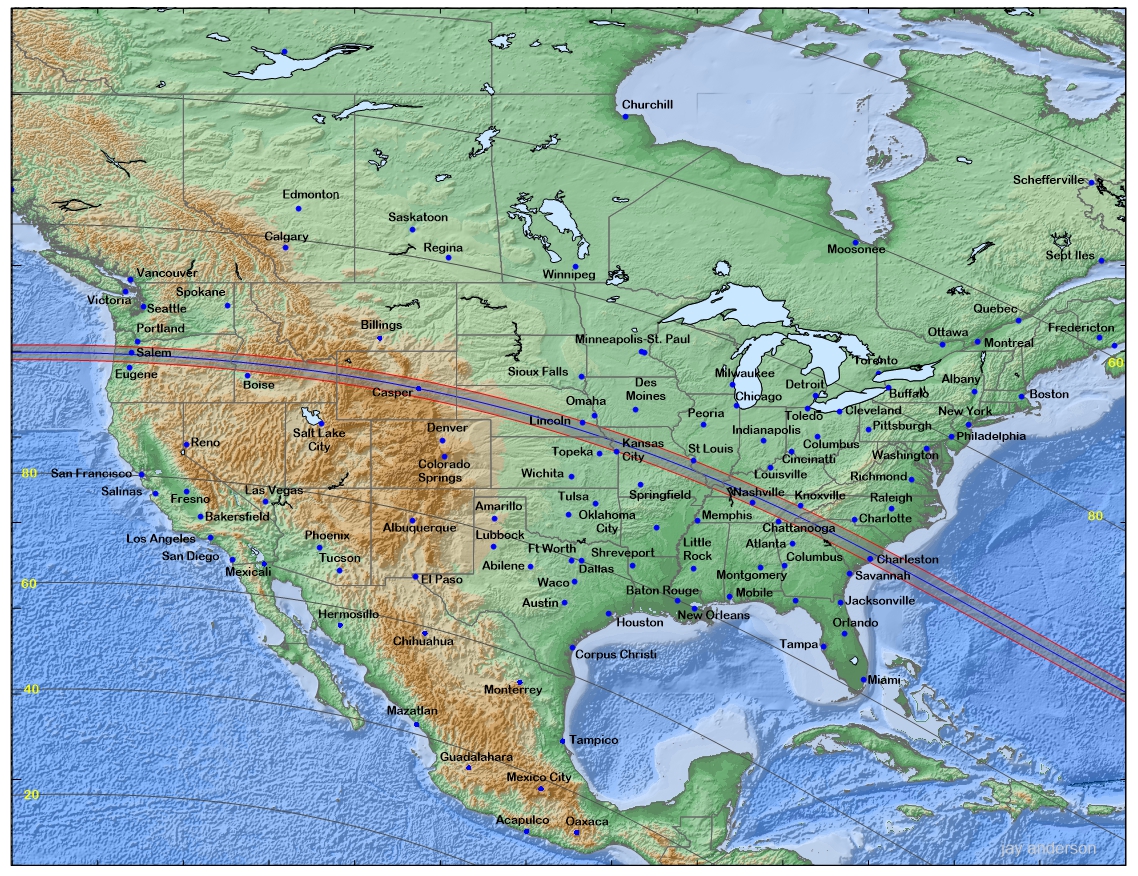
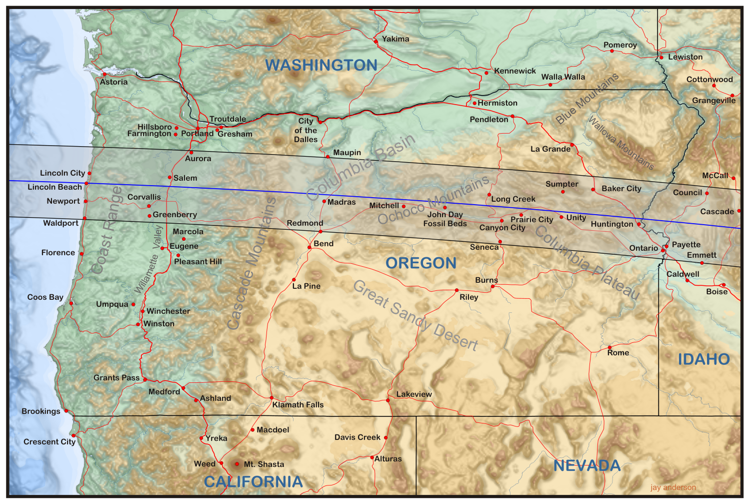
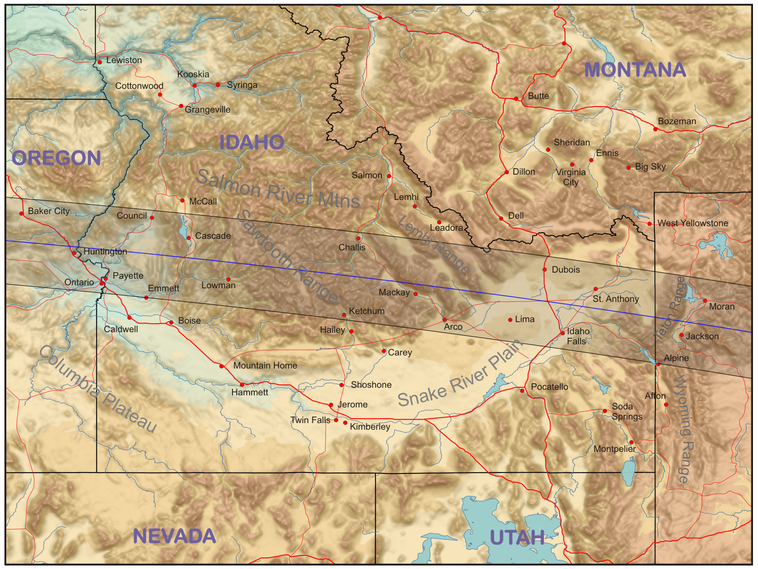
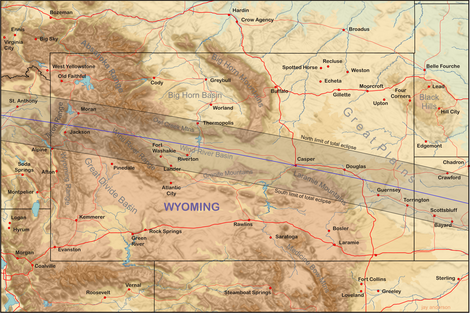
Oregon-Idaho-Wyoming
The Northwestern States enjoyed a sky that was largely free of cloud on eclipse day. Smoke plumes over Oregon and a thin band of cirrocumulus over Wyoming caused a small amount of concern, but for most watchers, the eclipse was a great success.
This animation shows the passage of the shadow over Oregon, Idaho, and Wyoming. Note the partial dissipation of convective clouds as the shadow passes and their re-formation as solar heating returns. Images source: NASA.
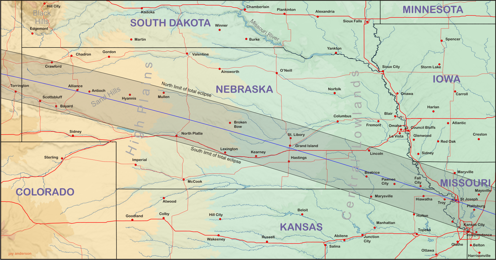
Nebraska and Kansas
Skies were much less friendly over Nebraska, where overnight thunderstorms in South Dakota pushed a strong outflow southward onto the shadow track. To the south, thunderstorm debris from Kansas angled along the border between the states. Between the two cloud regimes, a slot of clear skies rewarded lucky observers who were able to watch the eclipse before heavier cloud moved in. Only observers west of Alliance were able to view the spectacle without concern.
Animation of the passage of the eclipse shadow over Nebraska and Kansas. Note the dissipation of small convective clouds but not larger thunderstorms. Images: NASA.
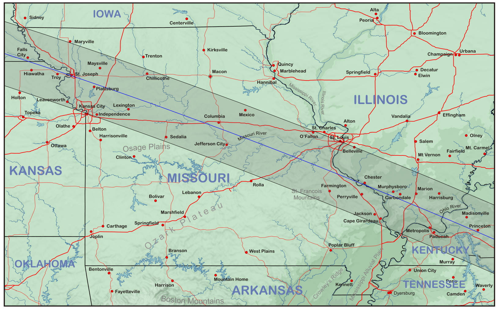
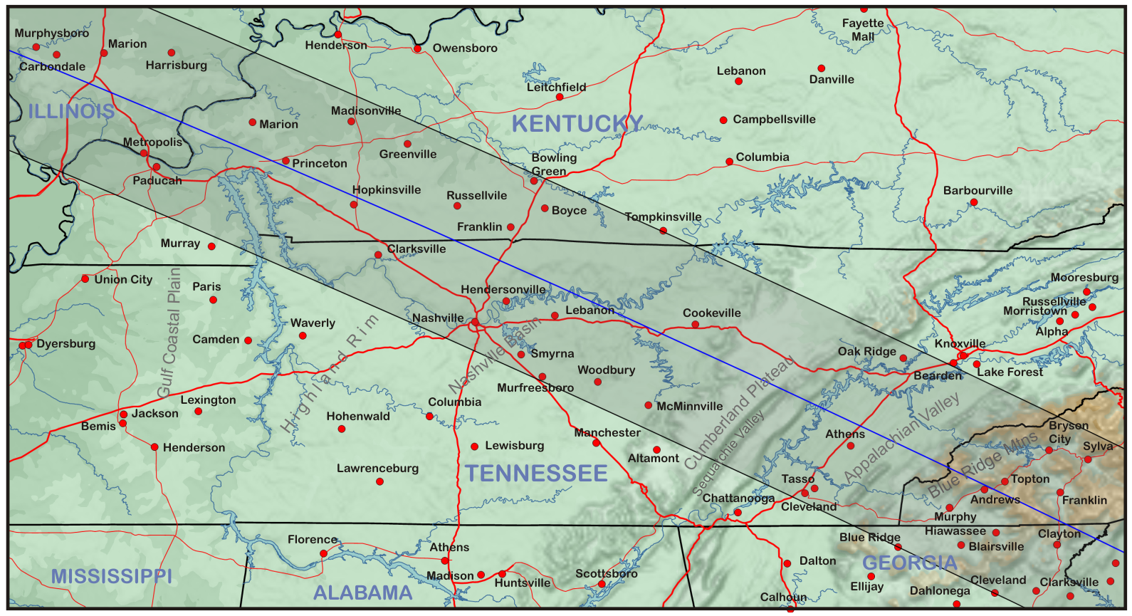
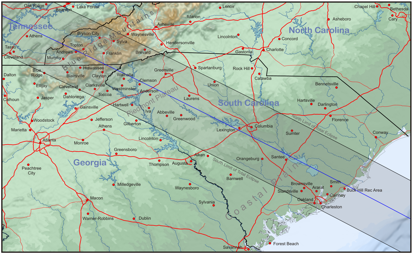
Missouri to South Carolina
From the Missouri River to the Atlantic coast, eclipse-day weather was characterized by widespread development of convective clouds. Most of these were small cumulus buildups that faded away as the shadow approached and the ground cooled. Only a few larger convective clouds—in southwest Tennessee and along the South Carolina coast— were able to withstand the eclipse cooling and survive the spectacle. The dissipation of the smaller clouds and their subsequent rebuilding are very evident in the animation.
Animation of the passing of the eclipse shadow over the Southeastern States. Images: NASA.
Temperature changes from satellite
The eclipse was prominent in visible wavelengths, but also showed in infrared observations. Infrared energy detected by the GOES satellites is thermal emission from the scene below and varies according to the temperature of the source. As the ground cools during the eclipse, infrared emission dropped and so the passage of the shadow can be seen as a faint change in the gray tones in regions where the ground is visible (primarily over the Northwestern States).
Animation showing a faint shadow of cooler temperatures moving across the USA. In this thermal infrared image, cooler temperatures show up as a lighter tone of gray (except where temperatures are below -48C, where they are shown in colour. The “cool shadow” is most evident over Oregon and Idaho, but can be distinguished faintly as far as the Atlantic coast. Source: NASA/RAMSDIS.
Updated January 2021
Return to eclipsophile home page